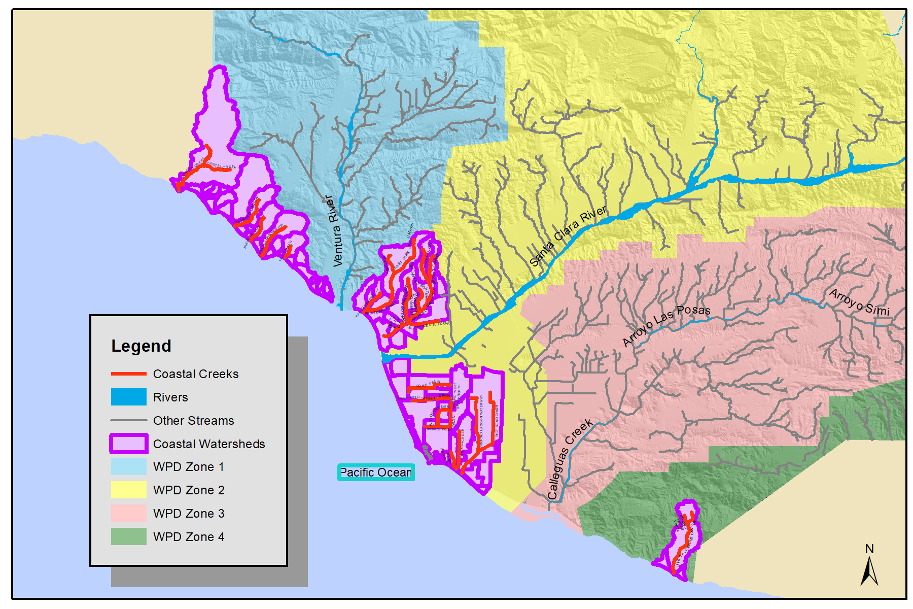
From the time the Watershed Protection District became steward of the County’s watersheds, it was recognized that the areas near our coastline, draining to the mighty Pacific Ocean, should be considered for their unique characteristics in watershed planning.
North Coast
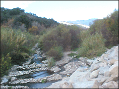
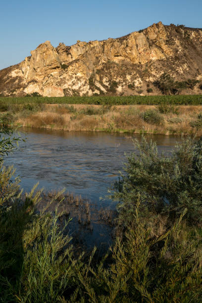
Starting at the Santa Barbara-Ventura County Line and going south, there are several coastal creeks that drain the face of the Santa Ynez Mountains (which are the southern end of the much larger California Coast Ranges). For hydrology purposes, this area is referred to as the “North Coast” of Ventura County which includes the principal stream of Rincon Creek, with lesser courses named Las Sauces Creek, Madranio Canyon, Javon Canyon, Padre Juan Canyon, and Line Canyon until we reach the unofficial southern boundary of what some call the “Rincon” coast which terminates at the northern banks of the Ventura River.
Ancient beach terrace deposits, unconsolidated limestones, siltstones, and sandstones dominate the local geology. Some surface seepage can collect in relatively thin lenses of permeable sediments and/or recent alluvium. Because beach-facing cliffs are often very steep and prone to landslides, most rainfall has a tendency to runoff rather quickly. Only in rare cases of time-extended precipitation does any deep seepage result in replenishment of groundwater supplies in the San Pedro Formation, channel alluvium, or beach sands.
With a close proximity to the Pacific Ocean, any water extraction wells that are drilled below mean sea level can be subject to potential seawater intrusion. Most wells in this area are shallow, with average depth-to-groundwater of about 50 feet (average depth depends upon annual rainfall, physical location, and wellhead elevation).
North Coast creek courses generally have a rather steep gradient with typically short total length, so none have sufficient flow to enable any consistent stream flow measurements. The Ventura County Hydrology Section maintains an automatic tipping rain gage (No.221) at the County Fire Station (in Seacliff) to track local precipitation. This rain station has recorded a long-term average (1965-2017) of nearly 16.5 inches per year (includes fog and wind-blown sea spray contributions).
Mid Coast
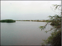
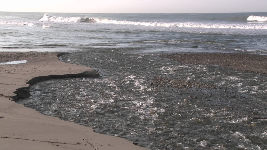
A loose interpretation of “Mid Coast” defines the minor stream courses between the Ventura River in the north, and Calleguas Creek-Mugu Rock to the south. Also referenced as the “Oxnard Plain Coastal Area”, this stretch of coastline is dominated by urban runoff containing high pollutant concentrations from residential and industrial activities.
Flat topography also means very little gradient or elevation differences between stream headwater areas and their termination at Ocean or Harbor exits. The result is low sediment load and highly concentrated chemical or mineral content of near-stagnant runoff, occasionally punctuated by significantly trash-filled dark-muddy debris-laden flash flows during intense rainfall events that pollute near-shore ocean quality for 3 to 5 days after each measurable volume rainstorm.
Mid Coast channel names are: Sanjon, Prince, and Arundell Barrancas; Oxnard West, Oxnard Industrial, Rice Road, Mugu, and J Street Drains; Naval Construction Battalion Command (NCBC) Canal; and the Revolon Slough.
South Coast
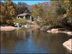
Runoff channels and stream courses between Mugu Rock and the Ventura-Los Angeles County Line are referred to as “South Coast” streams. These include La Jolla Canyon, Big Sycamore Canyon, Little Sycamore Canyon, and Deer Creek Canyon – all of which drain the the western extent (some say northern) of the Santa Monica Mountains. The next drainage to the south is Arroyo Sequit-Triunfo Canyon Creek, however that stream is just past the county line and thus under Los Angeles County control.
There are several varied rock types in the Santa Monica Mountains like hard basalts, rocky conglomerates, and thickly-bedded consolidated sandstones, meaning groundwater in this region is limited in quantity and there are no discernable aquifers. Streamflow is typically within shallow bottomed canyons or steep-sided “V” shaped drainages often coinciding with fault traces which often separate different rock types.
A County Rain Gauge (#232) at Deals Flat has recorded long-term (1968-2018) average precipitation of 20.7 inches per year. Although this rain station is approximately 2 miles inland from the coastline it provides a very accurate representative data point for the rugged topography of the South Coast drainage area.
